
Appearance
What Atlas is
Atlas is a CEP panel for Adobe After Effects (2024 and later, macOS and Windows) that builds maps as ordinary After Effects layers: shape, text, null and footage layers, with expressions where the map must stay live. There is nothing to "finalize": the panel builds and georeferences, After Effects animates.
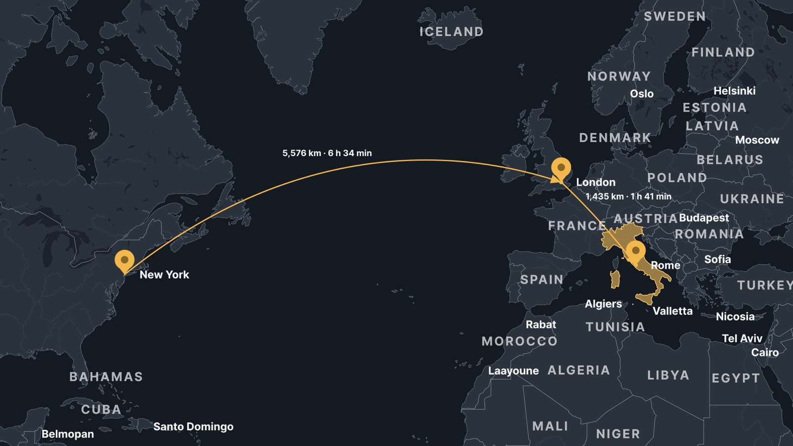
Pins, great-circle arcs with live distance labels, a highlighted country and labels, on a raster Mercator map.
- Two map modules that never mix. World builds countries, regions, the whole world or a globe from Natural Earth data bundled with Atlas (public domain, offline, ten projections). City builds street maps of anywhere from OpenStreetMap vector tiles (from OpenFreeMap online, cached; or a
.pmtilesregion file, offline), always in Web Mercator, zoom z4 (countries) to z16 (streets). Building one in a comp that holds the other replaces the map and keeps the pins, arcs and labels. - Raster or vector. Every map can be built as Raster image (one image, the default: plays at footage speed) or Vector shapes (editable shape layers).
- Everything hangs off one null,
ATLAS Map Root, whose sliders are the map's view (centre, scale, roll). Pins, labels, arcs and data layers are parented to it and positioned by expressions, so they stay on their places when the view changes. - A camera rig (
ATLAS CameraonATLAS Camera Target) adds tilt, heading, zoom and orbits over any map. - Update map reads the whole animation (the Root's keys and the camera's) and makes the map cover and stay sharp wherever it is seen, drawing closer zoom levels from OpenStreetMap when a World map zooms to street scale.
- Atlas Particles is a native After Effects effect, installed beside the panel, that draws moving data live in After Effects' renderer: journeys, events, recorded tracks, streams along arcs and routes, live heat maps and point clouds.
- Atlas MCP lets an AI app on the same computer drive Atlas through a local connector (topic Atlas MCP tools).
- Open data only: Natural Earth, OpenStreetMap (OpenFreeMap), AWS terrain tiles, NASA GIBS, EOX Sentinel-2 cloudless, national aerial surveys, USGS, NASA EONET, World Bank, geoBoundaries, OpenFlights. No account, no key. OpenStreetMap-derived output gets an automatic credit layer.
The panel's tabs follow the order of the work: Map (build the map), Style (its look), Elements (things placed on it by hand), Data (things from files and sources, particles), Camera (moves), and Settings behind the gear at the end of the tab bar. The panel always opens on Map.